

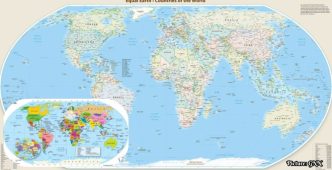
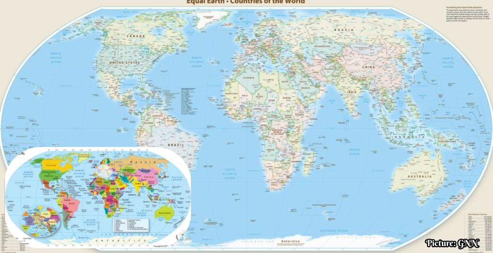
The United Nations General Assembly has voted to adopt a new world map based on the Equal Earth projection, aiming to rectify historical inaccuracies in geographic representation that have minimized the perceived size of African and other Southern regions.
The United Nations General Assembly voted on Friday, December 1, 2023, to adopt a resolution that seeks to correct the geographical representation of countries on world maps. This significant decision, referred to as the “Correct the Map” resolution, received overwhelming support from member states, with 164 votes in favor, six abstentions, and a sole dissent from the United States. The resolution was primarily championed by member states of the African Union, alongside support from the Bahamas.
The impetus for this resolution stems from a longstanding concern that existing world maps, particularly those based on the Mercator projection, contribute to a skewed perception of global geography. The Mercator projection, developed by the European cartographer Gerardus Mercator in 1569, has been widely used for navigation due to its ability to maintain constant true bearings. However, its use has been criticized for distorting the relative sizes of countries, particularly those situated closer to the equator, such as those in Africa and Latin America.
Historical Context of Geographical Distortion
Current mapping conventions often exaggerate the size of countries in the Northern Hemisphere, especially Europe and North America, while minimizing the representation of regions in the Southern Hemisphere. For example, on a Mercator map, Greenland appears larger than South America, though in reality, Africa is approximately 14 times the size of Greenland. This distortion has raised concerns that it perpetuates a Eurocentric worldview, diminishing the perceived importance and realities of countries in Africa and other Southern regions.
The UN resolution articulates that this distortion not only misrepresents geographic realities but also influences socioeconomic perceptions and development potential. It highlights that the skewed representations can fuel prejudices in various fields, including environmental and geopolitical discussions. As part of this initiative, the resolution proposes replacing the Mercator projection with the Equal Earth projection, which more accurately represents the relative sizes of landmasses around the globe.
The Equal Earth Projection
The Equal Earth projection, introduced at the 2018 North American Cartographic Information Society conference, presents a more balanced view of the world’s geography. Under this projection, Europe appears smaller, while Africa and Brazil are depicted as significantly larger than they appear on traditional Mercator maps. This shift aims to provide a more equitable visualization of the planet, addressing historical injustices in geographic representation.
French Foreign Affairs Minister Jean-Noël Barrot underscored the importance of this change, stating that “the United States, Russia, and China take on a disproportionate visual prominence compared to Africa, Latin America, or Southeast Asia.” He emphasized that such distortions can deeply influence public perceptions and called for a correction. France has committed to abandoning the Mercator projection in favor of more accurate representations, as reported by state-owned TV network France 24.
Global Reactions and Implications
The resolution’s passage follows the African Union’s earlier adoption of the Equal Earth map in March 2023, and a subsequent request from Togo, representing the AU, to UN member states in April to endorse the same. This collaborative effort reflects a growing recognition of the need for equitable representation in global maps, particularly among nations that have historically been marginalized in cartographic practices.
A spokesperson from the African Union, Amma Twum-Amoah, remarked in March that “Africa, once diminished on maps, now insists on being seen at its true scale – geographically, historically, morally, culturally, economically, diplomatically, and globally.” This statement encapsulates the broader implications of the resolution, which seeks not only to correct geographic distortions but also to address historical narratives that have contributed to the marginalization of African nations.
New Zealand has also raised concerns about the Mercator projection, as evidenced by a tourism advertisement featuring then-Prime Minister Jacinda Ardern in 2018, which humorously noted that “New Zealand is disappearing off the world maps.” The Equal Earth projection addresses such concerns by offering alternative centering options, including one that centers Oceania rather than the traditional Greenwich meridian.
As digital mapping platforms like Google Maps continue to utilize variations of the Mercator projection, the UN resolution encourages these platforms to collaborate with member states and regional organizations to adopt the more accurate Equal Earth projection. This call to action highlights the significant role that technology and media play in shaping public perceptions of geography and global dynamics.